Woolsey Fire map: See where the wildfire is burning in
Ventura, Los Angeles
Source: Curbed Los Angeles
The Woolsey Fire broke out Thursday afternoon near Simi Valley, and by Tuesday afternoon, it had consumed an estimated 97,620 acres in Los Angeles and Ventura counties.
The size of the fire now measures more than 150 square miles, Los Angeles County Fire Department Fire Chief Daryl Osby said Tuesday morning—roughly the size of the city of Denver.
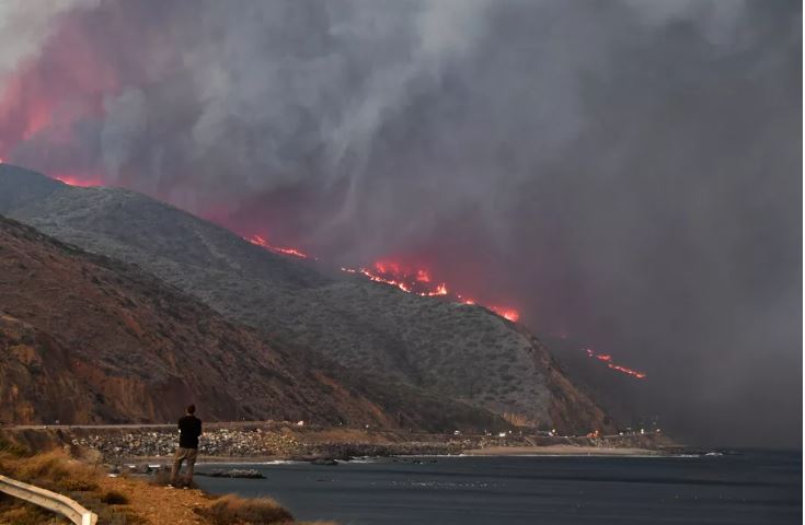
Fueled on Friday by low humidity and gusty winds, the fire tore through Malibu and neighboring canyon communities, as well as parts of the San Fernando Valley neighborhood of West Hills. Mandatory evacuations have been lifted for many of the 170,000 residents of Los Angeles County who were forced out of their homes on Friday.
Containment is now at 47 percent.
As images of smoldering houses suggest, there has been “significant structural loss,” Los Angeles County Fire Department Fire Chief Daryl Osby said Friday afternoon.
It is estimated that 483 homes buildings have been destroyed, but that number is likely to increase as officials continue to survey neighborhoods.
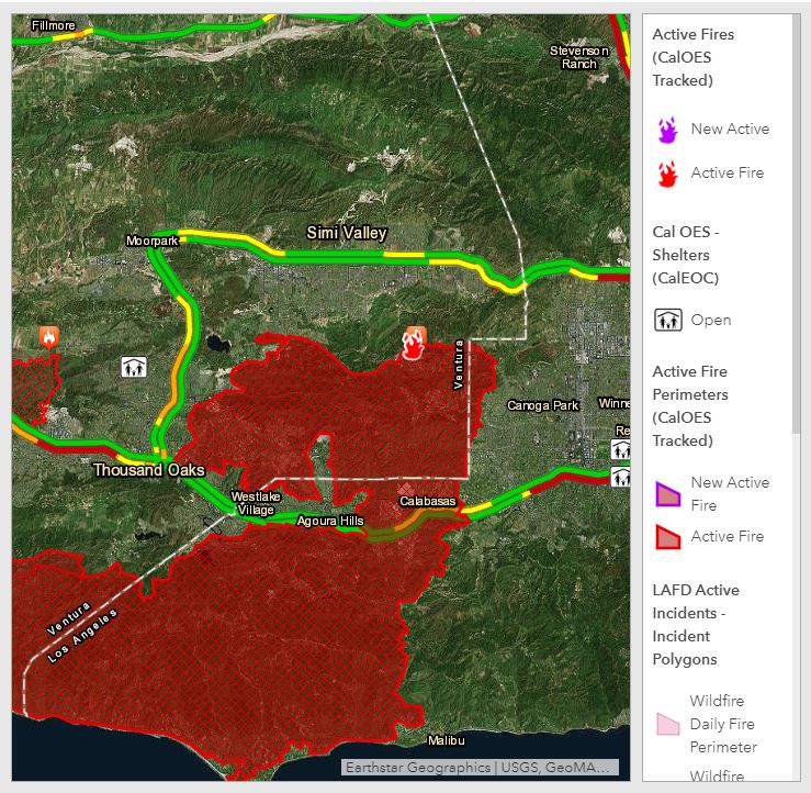
The path and perimeter of a fast-moving wildfire can be difficult to track. But with the help of a couple of maps, it’s easier to see where this fire is burning and get a handle on how much the two counties have been affected in just a short amount of time.
(Click here for live updates of the Woolsey Fire as it tears through Los Angeles.)
The map immediately below is a Los Angeles Fire Department map that shows the fire’s massive perimeter as well as mandatory and voluntary evacuation zones.
The shaded yellow area represents the perimeter of the volatile fire. Mandatory evacuation zones are outlined in red; far fewer are the orange sections, which represent voluntary evacuation zones.
Below is a map created by ABC7 using information from the California Office of Emergency Services, which tracks active wildfires in the state. (It takes about a minute to load.)